Mongol and A World of City States Without Border
Before human civilizations were able to raise horses in large numbers, a common man was only able to venture a few kilometers away from his settlements and his water sources. When humans started to develop farming techniques, our civilizations became even more concentrated around major water sources.

While trees could grow their roots deep underground for water sources and bird could spot lakes and river kilometers away and fly for hundred of kilometers non stop, farming society even with the wheels only can develop settlements 100 - 200 square kilometers in size and few become wealthy enough to maintain a large army and build fortified castles and walls around its administrative body.

There was not a national border line and clashes happened regularly at the middle points between two major rival settlements. While the modern ground vehicles need to travel on paved roads, the horses are all terrain vehicles that could travel on almost all earth surfaces and allows the mounted archers and calvaries to maneuver around unguarded empty lands between major human settlements.

Maybe this is the reason why Moscow and Beijing were both built faraway from nearby water sources and were two tributary city states to the Western Mongol of Golden Hordes and the Eastern Mongol of Yuan. While Russia's modern largest city, Moscow, has the size of around 2,015.59 square km, Vietnam's size is 331,690 square km or 165 times larger than Moscow.

So without a modern early warning system, most cities and towns of Eastern Europe and China were probably not able to prepare for a Mongol invasion or mobilize their army fast enough to choose a favorable location of their battlefields.
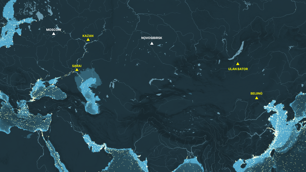
From the largest freshwater lake on earth, Lake Baikal, the Mongolian genetics lineage first spread along the Orkhon river system then quickly accelerated with the adoption of large horse archers formation in their army and climate changes in the 13th century that expanded the grassland of Central Asia.
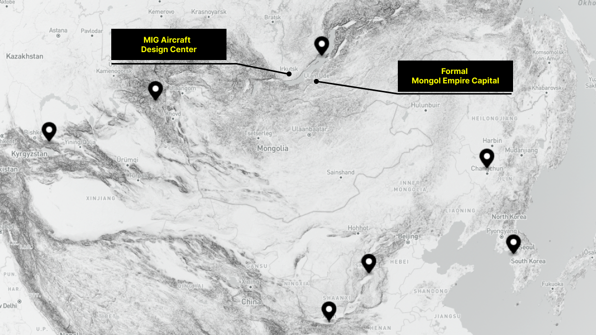
The massive grassland of Central Asia enabled the Mongolian army and their genetics to spread along from Lake Baikal to the Black Sea and Northern China with Mongol settlements being built near the Volga and Yellow river and became modern day Stalingrad and Beijing. The grassland boundary of Central Asia marked the limit of Mongolian expansion just like the oil fields of Europe marked the limit of German merchanized army expansion.
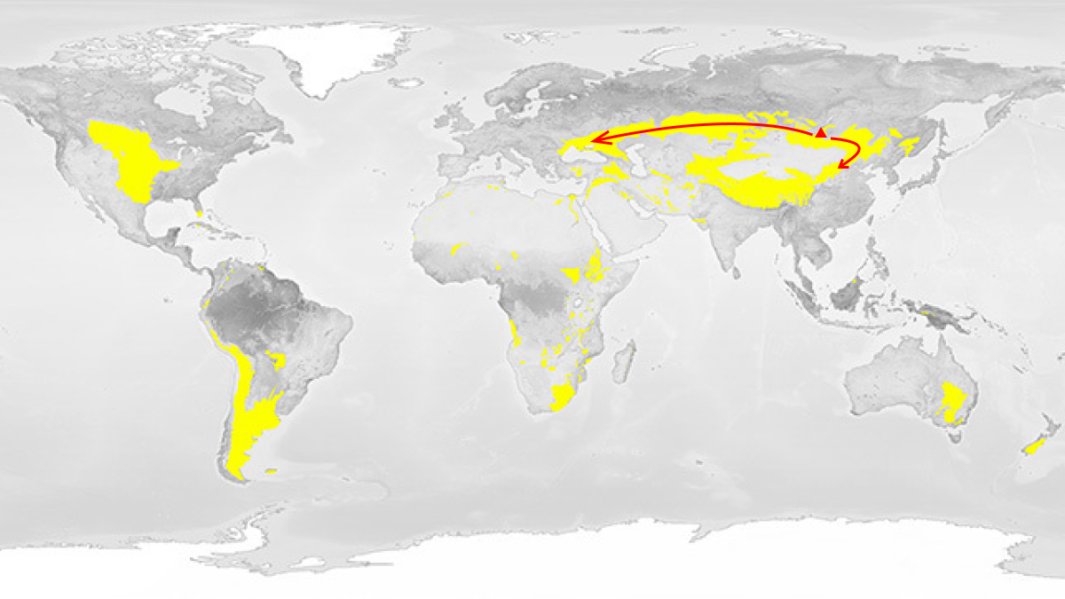
The spread of Central Asian horsemen genetics was only stopped by the Christian churches of Roman Empire. The Christian planners setup two traps: the fortified castles of Moscow and Constantinople to take advantages of Western European adaption to cold climate and naval strength. Moscow is too far up north and too cold for grass and horses while Constantinople is a narrow naval stroke point in a dead end. Countless horsemen of Central Asia lost their horses and lifes trying to take the two fortifed castle of Moscow and Constantinople beyond the limit of their supplylines. Hungary and Constantinople is too far for a grass eating horse army and Stalingrad is too far from the oil fields in Ukraine.
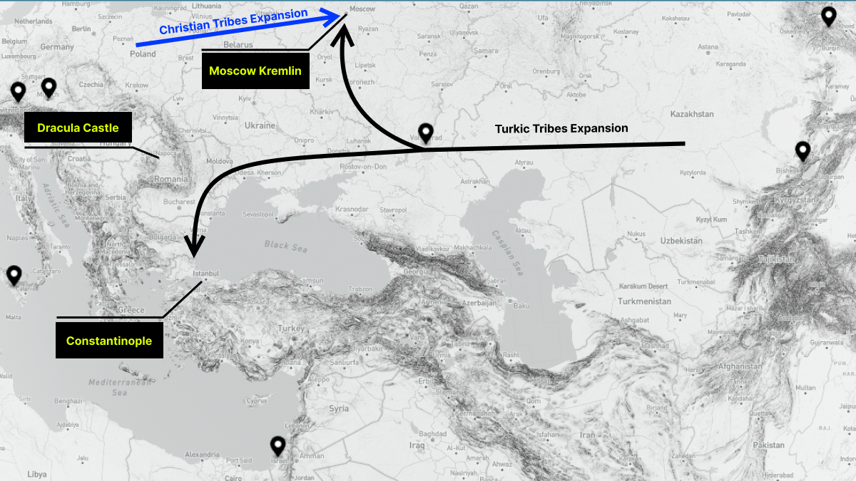
While Constantinople was eventually fallen, the Turkic genetic clusters in Turkey lost access to the massive grassland and the line of communication to the Central Asian tribes. Turkic tribes of Turkey have to settle in a small area around the sea of Marmara without a major river, delta or flat land for population expansion.
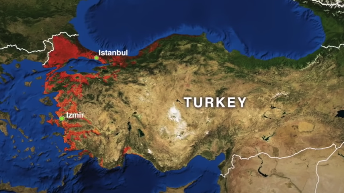
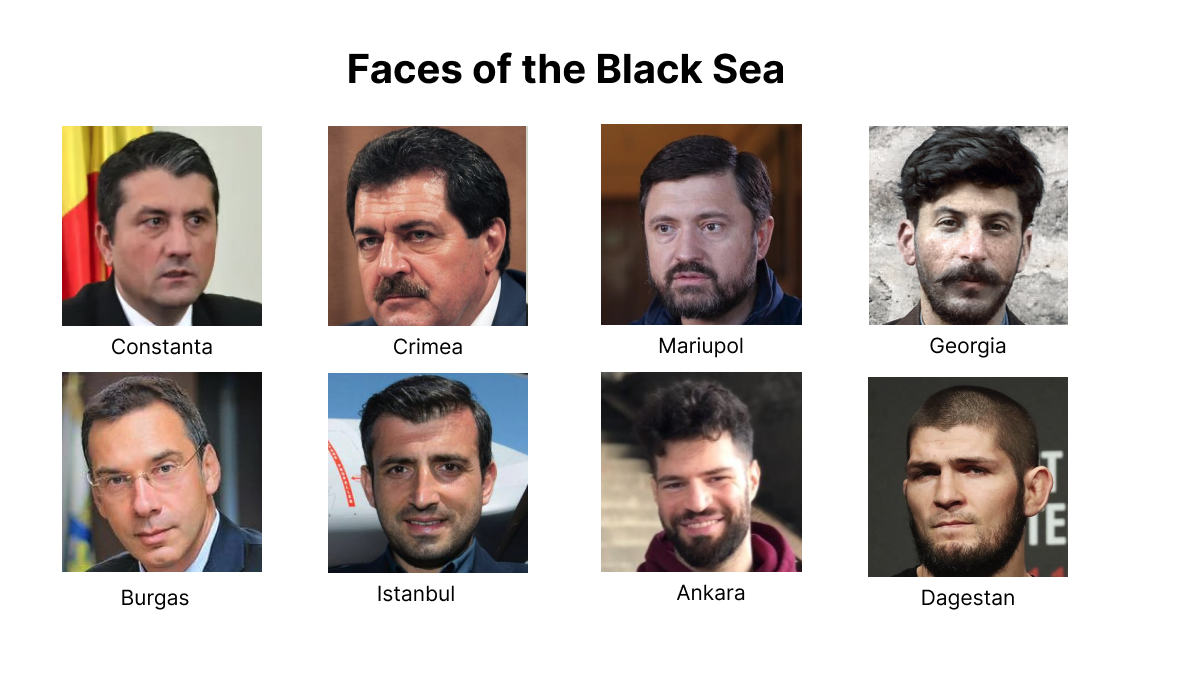
There is nothing Black about the Black Sea except the hair color of the people living near the coastline of the Black Sea from the Caucusus to Bulgary. Maybe this is the genetic mark that the turkic tribes left behind during their expansion from Central Asia to the Draculas castle near Hungary.
World Wars and The Invention of the Nations and National Borders
While it is possible to guard a walled city and its nearby surrounding area with foot soldiers and horses, it is not possible to guard the large borderlines of 3765 km in the case of Ukraine with foot soldiers and horses, especially if the borderlines are not behind major not easily crossable-terrain like high mountains, river or deep ocean.
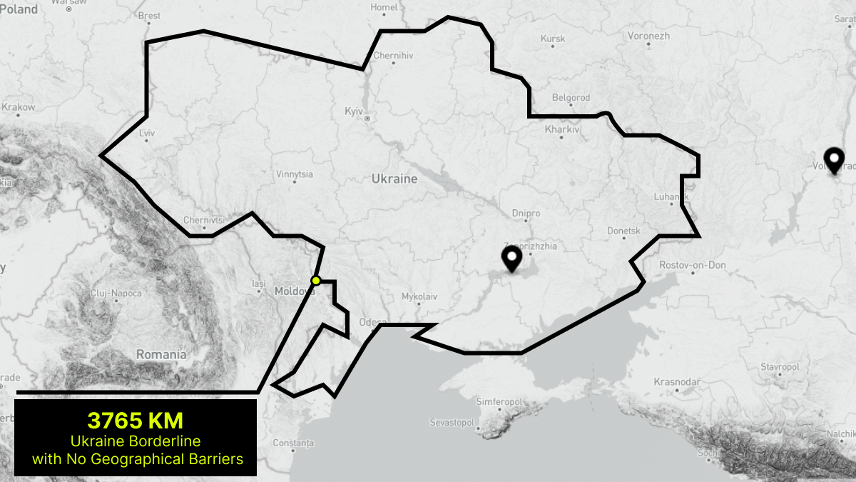
Assuming two guards with arrows, horses and spears could be stationed 30 meters from each other, you would need a minimum 120,000 - 130,000 guards to create a very thin 4000 km line of defense that could be easily penetrated by an invading force. With the Roman Shield Walls of three layers, you would need 4,000,000 guards standing at the border 24/7 with their shields and armors. Building a 4000 kilometer physical wall is even more human resources and time intensive that is also not effective against explosive powder, ladders or trebuchets.

It is an ineffective and unrealistic task of guarding a borderline in the ancient era. So there was no borderline in the pre-World-War era. Human tribes just guard city states or walled garrisons and send messengers to the other smaller tributary city states for help when there is an invading army or combine forces with other tributary city states to invade a rival city state.

Before the radio-com, combustion engine and machine gun was invented, a country was a cluster of loosely aligned city states with one central city state and the tributary city states. The local city mayors of the ancient era are the kings while the city mayor of a central city state is the emperor.

With the invention of machine guns, shield walls and large soldier formations become a massive attack surface that a single gunner with enough bullets can eliminate all at once. A tall city wall could be penetrated or shot over with artillery from a distance. The defensive line now needs to be pushed much further away from the city border and the army needs to dig a trench to get out from the line of fire of machine guns and artillery.
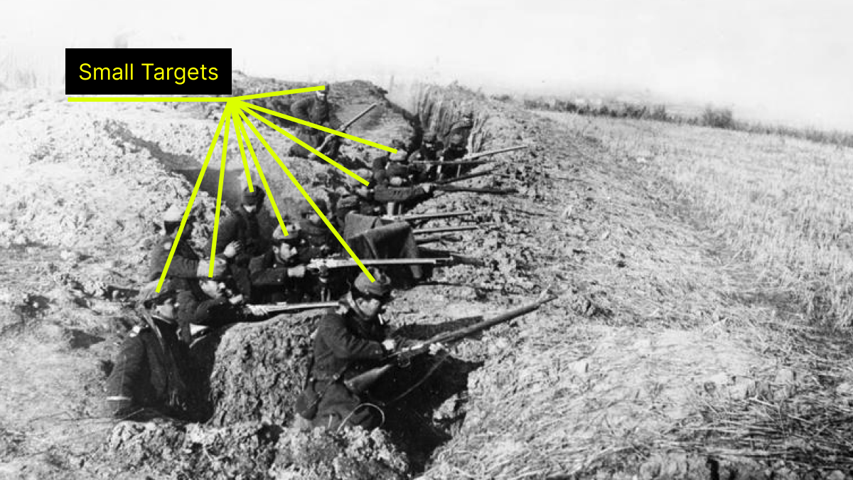
Human weapons of World Wars had such a high rate of fire and accuracy that the best strategy is to minimize attack surfaces by laying on the ground or hiding underground behind in a trench. Trench warfare of World War I and II is the beginning of a long battle line and the beginning of national borders.

Modern Day Guide to Redraw The Earth Border Lines
Since the fall of Saigon in 1975, national borders around the globe have remained relatively constant and unchanged.

The US and NATO prefer to maintain the earth borderline and just redraw the line between allies and enemies through regime change by replacing the people in charge of the exact same territories like in the case of Panama, Iraq, Afghanistan or Ukraine.

China prefers to use trade as a bargaining chip to achieve territorial gains like in the case of Hong Kong and South China Sea islands. The British willingly gave up Hong Kong in exchange for more trades with mainland China while US and ASEAN slowly gave up contesting the Islands in South China Sea to focus on domestic economic issues.

Russia and the Soviet Union prefer to use the secession movements either through the collapse of the Soviet Union in 1990 or independence movements in Georgia, Crimea and Donetsk to redraw earth borderlines.
Any attempts to redraw the earth borderline by smaller nations have always failed like in the case of Iraq wars with Kuwait and Iran and the Vietnam war with Cambodia. Israel is the only exception with small incremental gain via settlement building in the West Bank.

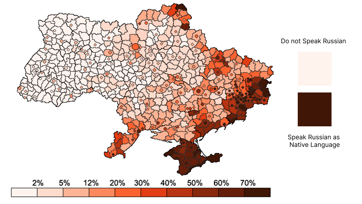
It seems like only nations with a domestic defense industry and being able to doge arm embargo can really alter the earth's borderline successfully. Common spoken language is also crucial in the success of any attempts to acquire new territories. Hong Kong citizens use both mainland Mandarin and southern Cantonese. Large percentages of Laos and Thailand citizens speak Mandarin. Palestinians speak both Hebrew and Arabic. Georgian and Ukrainian speak both Russian and Ukrainian.

Being able to export your languages and your domestically made weapons are two crucial steps in achieving long lasting territorial gains in modern day. Posessing nuclear weapon is also another crucial factor that allows America, Russia, China and Israel to pressure nations to concede small territorial lost to avoid decapitation strikes on command control nodes.
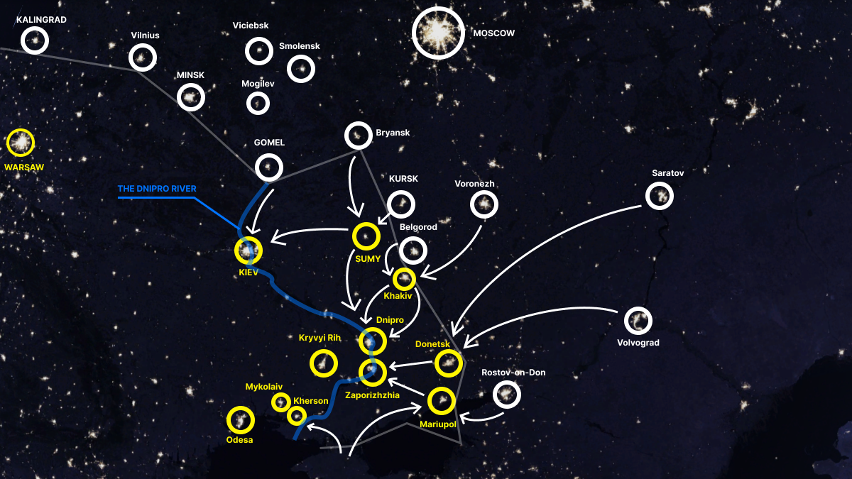
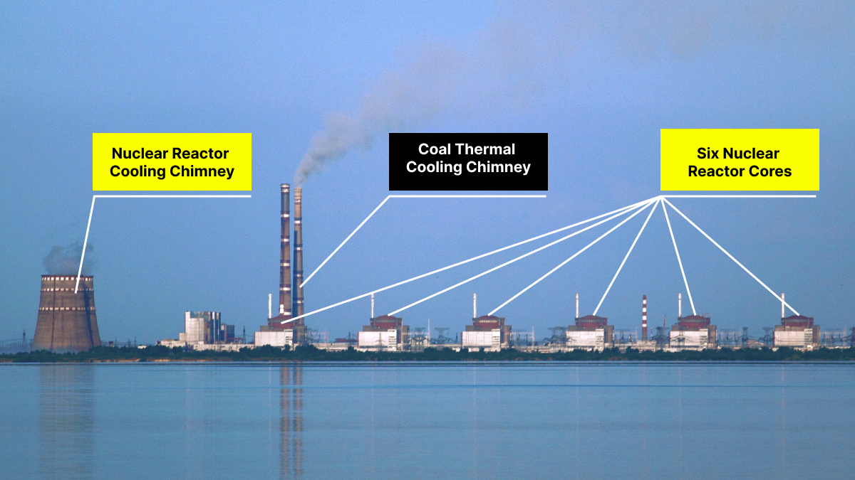
If we take the Ukranian war as an example, within the first few months of the war, Russia was striking two targets: Kiev, the capital city of Ukraine and Zaporizhzhia, the largest nuclear power plan of Ukraine and Europe to demonstrate its abilty to strike Kiev with nuclear weapon if it wants to.
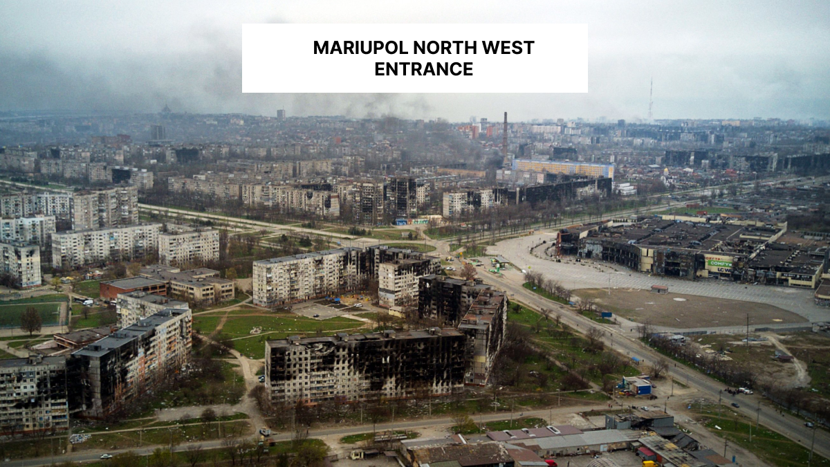
Russia then consolidated pre-war territorial gains by securing water sources for Crimea, connecting Crimea and Donetsk by striking Mariupol and build buffer zones around these two secession regions. Moscow once again achieved territorial gain in 2022 with the same formula but at much higher cost then before.
